Oisterwijk
Client
Surface
- 11,2 ha
Year of design
- 2014 - 2016
Year of fulfilment
- 2016 - 2018
Activities MTD
public space manual, design plan
public space, supervision, assessment of implementation preparation
Competence
- public space
- business parks
- terrains around buildings
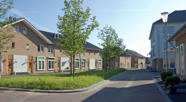
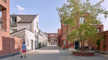
With the closure of the Koninklijke Verenigde Leder (KVL) in Oisterwijk in 2000, an extensive, historic factory complex became available. The municipality of Oisterwijk and the Province of North Brabant had the joint ambition to redevelop and transform the complex and the adjacent sites, a total of approximately 11 hectares, into a new multi-colored living and working area, whereby the industrial buildings have been retained and restored and approximately 330 new homes and apartments have been added. A new program has been introduced for (national) monumental buildings; they looked for a combination of catering, culture, healthcare functions and retail. In the meantime, a number of companies have already established themselves, such as the European Ceramic Center and baker Robèrt, and a completely new dynamic is emerging on the site. The site exudes a special industrial atmosphere and includes a number of buildings and elements with a (national) monumental status; they form a valuable ensemble.
MTD landscape architects was commissioned in 2014 to draw up a public space design plan for a new living and working area on the KVL site. This is based on the Master Plan, the Visual Quality Plan and the Urban Development Plan for the KVL site, as drawn up by DiederenDirrix architects.
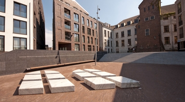
The public space development plan for the KVL site focuses on preserving the industrial and rugged, functional atmosphere around the (national) monumental buildings and a direct connection between the industrial core and the adjacent residential areas. An important point of reference here is the orthogonal coordinate system, along which the (national) monumental buildings were originally arranged. This coordinate system is directly related to the former railway lines and an underground corridor system and actually symbolizes the former industrial production process. In the Public Space Development Plan, the orthogonal coordinate system is laid down by means of courses of Stelcon plates. Within this orthogonal system, a number of important open spaces are present within the (national) monumental core of the area; the space between the U building and the boiler house with the monumental plane trees and the entrance space, between the main building and the EKWC building, with the limestone monument. To complete this entrance square, the entrance gate and gate have been returned; a contemporary version of the original fence and gate. They mark an important entrance to the KVL site from Almijstraat. The open spaces within the (national) monumental core have acquired an important green quality. To this end, convex, rough lawns have been introduced, surrounded by a wide concrete band. They have an important meaning in staying in public spaces and each has its own atmosphere and quality of use. The coherence between the (national) monumental cluster and the residential area is mainly determined by the public space; the orthogonal coordinate system and the continuous access line form important structural supports. The continuous access line has a continuous profile of approximately 14.0 meters wide and is accompanied by an avenue of elms. Low and higher, vegetated garden walls border the private garden plots here. The residential streets, which provide access to the homes from the central access line, are slightly more modestly sized. They are characterized by an approximately 9.0 meter wide, asymmetrical profile without tires. In addition to approximately 1.0 meter wide sidewalks, parking is arranged in separate approximately 2.0 meter wide parking lanes. This zone also contains the nut trees (Juglans nigra) on one side of the profile. Low and high beech hedges border the private plots here.