A2
Client
- Steunpunt routeontwerp (ministerie VROM en LVN)
Surface
- 212 km
Year of design
- 2006 - 2007
Activities MTD
vision road environment
Competence
- infrastructure
- vision
In the near future a large section of the A2 will be tackled; hence there'll also be an opportunity to tackle the immediate surroundings of the motorway and so too the perception from and of the roadway. In the last few years a good accessibility and visibility have resulted in the immediate surroundings becoming an attractive establishing environment for business premises, acoustic barriers and billboards. However, there's an increasing social resistance to the clutter and fragmentation of the landscape caused by such development. And the parties involved; the former Ministry of Transport, Public Works and Water Management and the former Ministry of Agriculture, Nature and Food Quality (LNV), the Public Works Department and Water Management (RWS), the provincial authorities, Water Boards and local authorities, have a mutual aspiration to improve the spatial quality of the motorway landscape.
In 2006 MTD landschapsarchitecten was commissioned by the Public Works Department and Water Management to draw up a route design for the A2. In the first instance the main objective of this assignment was the development of a guideline for the spatial developments of the motorway and its immediate surroundings, and also to create support amongst the public authorities and market parties involved.
the design
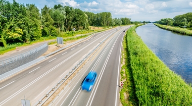
The A2 can be typified as a city and country route; the roadway runs along the major centrally situated cities in the Netherlands, which are separated from each other by the large landscaping entities: Amsterdam / the Green Heart / Utrecht / the rivers area / ‘s-Hertogenbosch / the Brabantse Zandgronden [sandy soils of Brabant] / Eindhoven / Peel en Maasdal [valley] / Maastricht / Limburgse Heuvelland [highlands of Limburg]. The A2 route design will boost the characteristic alternation and the contrast between the city and the countryside. Here the classic image of the city surrounded by its countryside loses territory in favour of the network city, where the countryside forms part of the urban networks. In this sense it is of vital importance not so much to restrict the city, but rather to point out, restrict and shape the scale of the landscape and the road user's rate of perception.
Here five thematic schemes have been determined by the parties involved; cityscape and image: boosting the appeal of the urban area; national landscapes: showcasing and drawing attention to our national landscapes; a recognisable culture landscape: improving the readability of historical structures and elements; lateral relations: the development of ecological, recreative, infrastructural, urban and hydrological structure elements which connect both sides of the road; regional work landscapes: interregional cooperation for commercial development, having a strong presence and a careful fitting-in.
Two strategies are used to accomplish this. For urban sections the strategic challenge is geared towards the boosting of the attractiveness of the urban area; the tendency of city-branding is maintained and enhanced. The strategic challenge for the countryside sections is geared towards the preservation and strengthening of the individuality and recognisability of the large landscaping entities. This marks the transitions from the city to the landscape.